Laser scanning makes it possible to turn almost any subject or area into a digital 3D model faster and more cost-effectively than with traditional methods. We use the most advanced tech in the field made by Riegl.
Surveying technology for the new age
Laser scanning converts everything the eye can see into a digital form. Comprehensive and to-scale point clouds enable you to measure and inspect the area without having to return to or even visit to the site to begin with.
- Cost savings from the get-go
- Less risks in design projects
- Data can be created with natural colors
- Accuracy of 5 millimeters with laser scanning
Laser scanning - step by step
Planning of the surveying process
Planning phase includes defining the goals and needs of the client.
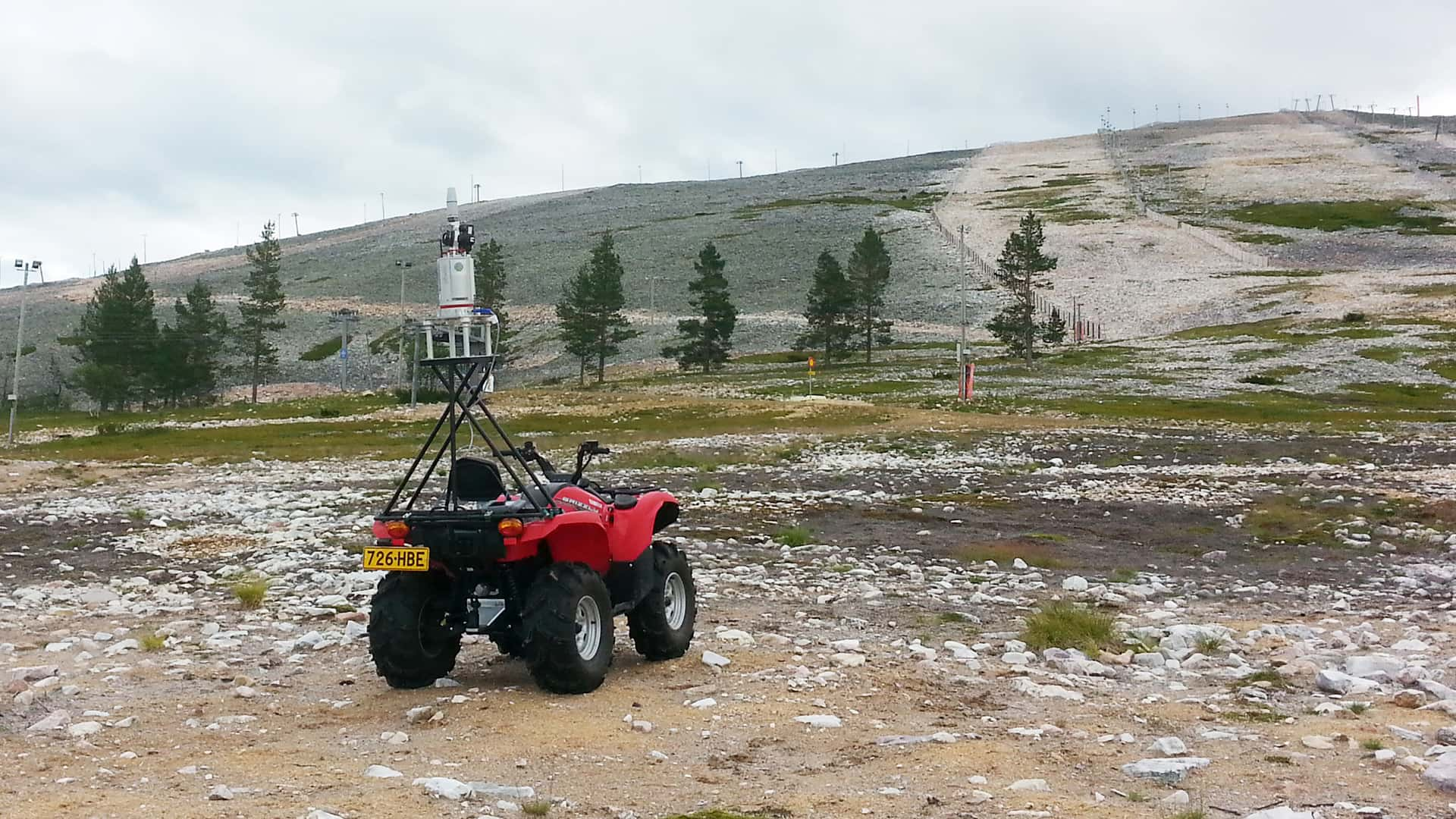
Scanning the subject
Laser scanner set on a tripod revolves and sends an immense amount of laser rays to different directions.
Creation of point clouds
Laser rays reflect back upon colliding with surfaces. Returning ray is recorded and converted into a point location.
From scanner to desktop
A detailed 3D model can be quickly created from the finished point cloud.

To-scale construction drafts with 3D-scanning
By utilising the scanning data we will create construction drafts and 3D models for flexible usage including HVAC and electricity engineering needs. The benefits of using the same data set for everything are among other things the time and cost savings.
Illustrations and visual presentations
One picture is worth a thousand words, so one 3D model must be worth a whole lot more. We can also produce captivating videos to help visualise modelled subjects or areas.
Have a look at our projects
Frequently asked questions
-
Is laser scanning safe?
Yes, because the laser in question is low-powered. It doesn’t harm eyes, tissue, plants or other vulnerable surfaces. The device does not ’touch’ anyhting, it only observes.
-
How does laser scanning differ from traditional methods?
One of the largest differences is the speed. Laser scanners can reach a speed of 500 000 points per second. Surveying a building’s surface with a tacheometer requires at least ten times the hours when compared to laser scanning.
-
What benefits do point clouds provide?
Point cloud data is more accurate and importantly massively easier to handle than traditional surveying or measuring data made with a tachometer, measuring tape or laser distance measuring. A finished point cloud is to-scale data of the real world without human error and slow pace of traditional methods. As an example, alcoves, overhangs and curved surfaces are usually slow or altogether impossible to measure accurately with old methods.
-
Does laser scanning provide a benefit in real estate?
Yes. The subject and it’s surroundings can be digitalised as a whole, in precise scale and with natural colors, by utilising laser scanning. The data and material provided by Atlastica can be used in sales material, but also to research the subject’s proper wear and tear, area size and value.
Large real estate deals are complicated and lenghty procedures. Risk management is essential for both parties. Atlastica’s laser scanning provides several benefits and applications:
- Because the data is accurate and doesn’t have inconsistensies or ambiguousness, the subject can be presented in a trustworthy form to a potential buyer before even visiting the site.
- Possible errors or problems in the subject – or a lack thereof – can be brought to both parties’ attention early, which prevents disputes, lessens the risks and helps in the valuation.
- The true area size of the real estate can be accurately calculated.
- In the case of a dispute the data can be used in court.