Starting point
Fingrid Oy needed accurate and reliable baseline data from its substation area as a basis for future expansion and modification projects. Outdated materials were to be replaced with comprehensive and modern digital base material that would ensure high dimensional accuracy during the design phase and reduce project risks.
Implementation and state-of-the-art equipment
Substation area
Approximately 5 hectares
RIEGL VZ-400i
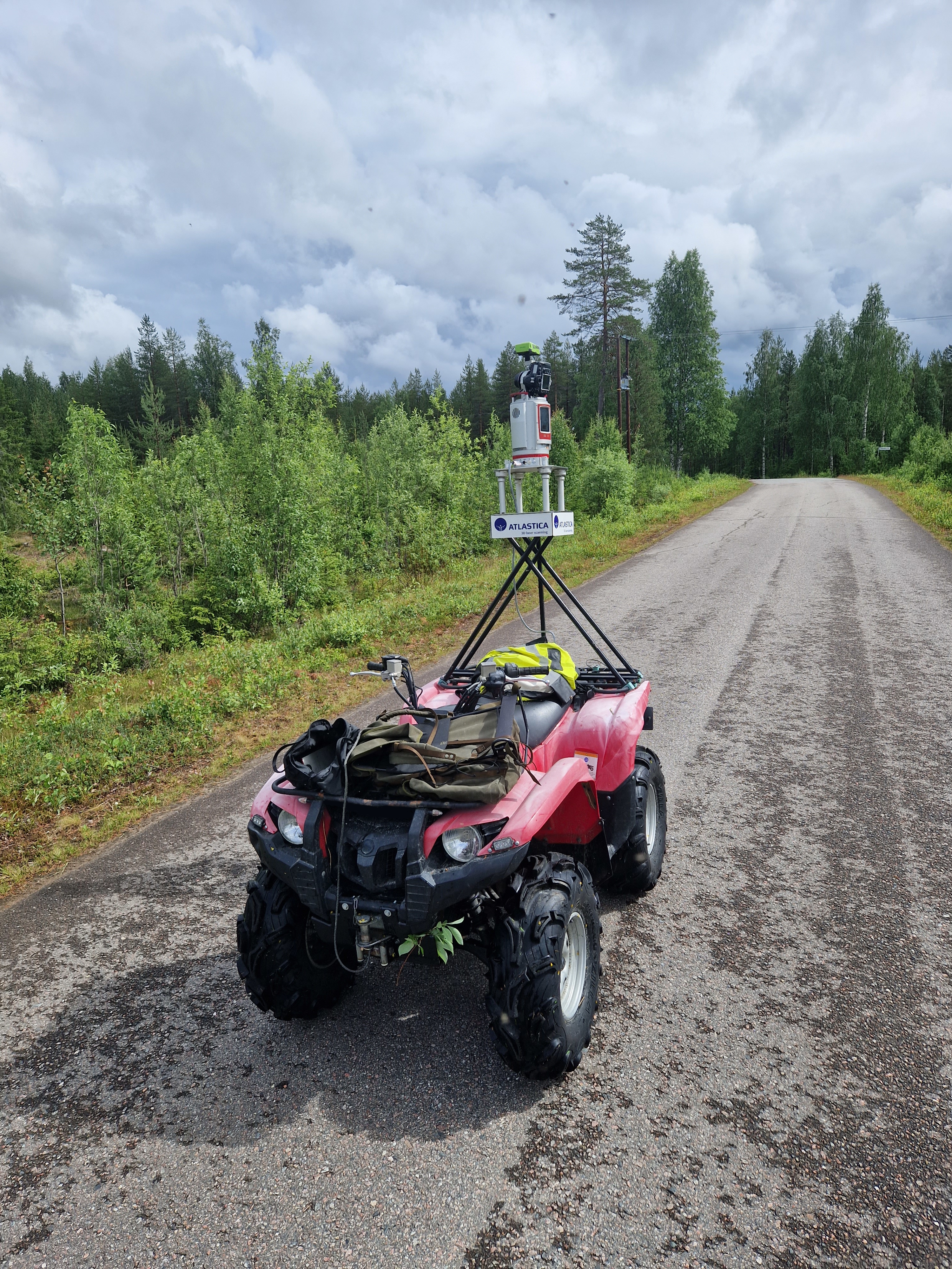
The area was scanned using a RIEGL VZ-400i laser scanner mounted on an ATV. The method enabled fast movement and uninterrupted data collection in a demanding substation environment while taking safety requirements into account.
Deliverables
- A 3D point cloud produced by terrestrial laser scanning, showing the substation structures and terrain features in detail
- Personal user credentials for the RiPano service, making the data easy to use
- Browser-based access to the data for the entire design team
Cost efficiency and smoother workflows with RiPano
The completed three-dimensional point cloud was uploaded to Atlastica's cloud-based RiPano application, making the design team's work easier and saving resources:
Design directly from the desktop
Because the substation data can be reviewed remotely, designers do not need to travel to the site to carry out checks. This saves a significant amount of time.
Lightweight browser use without software purchases
The extensive 3D material is available to the entire team through a standard web browser without expensive specialist software or large file downloads.
Versatile remote measurement tools
Users can take accurate measurements from the data, review the site in panoramic views and create the required cross-sections directly from their own workstations.
Result
Starting point
The baseline data for the yard and road areas of Kemijoki Oy's Kitinen hydropower plants was not up to date for design purposes. Accurate and high-quality baseline data was needed as a basis for the yard and road programme and maintenance.
Implementation and equipment
All Kitinen hydropower plant areas
More than 10 hectares of scanned area
The terrain was captured by drone over a total area of approximately 60 hectares
The areas were scanned using a RIEGL VZ-400i laser scanner mounted on an ATV. In addition, extensive drone imagery was produced from the sites to support the design process.
Comprehensive deliverables for design
Kemijoki Oy received an exceptionally comprehensive and accurate digital data package, which included:
- A detailed point cloud of the yard and road areas based on terrestrial laser scanning.
- High-quality aerial images created from drone imagery.
- A point cloud processed from drone data for selected sub-areas.
Cost efficiency and savings with RiPano
The completed 3D data was uploaded to Atlastica's easy-to-use RiPano service, bringing significant financial and time-saving benefits to the project:
No unnecessary site visits
Because the project designers worked in different locations, the RiPano service reduced long drives and site visits to the hydropower plants. All details, measurements and visual information could be reviewed directly from the desktop.
All data in the browser without licence fees
The entire design team could access the same extensive point cloud and image material through a standard web browser, without expensive software or large file downloads.
Remote measurement tools
Designers could carry out checks, distance measurements and cross-sections directly from the data at their own workstations.
Result
Starting point
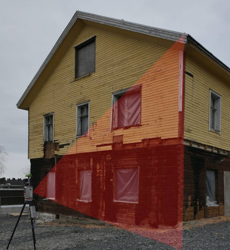
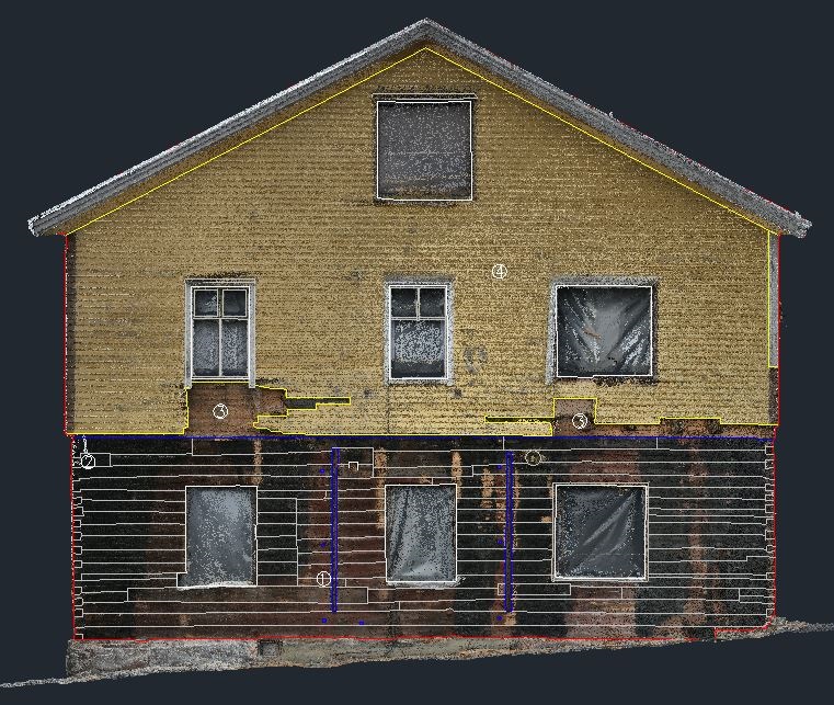
Located in the Tuira district of Oulu, the former office building of the Merijal confectionery factory is a valuable building completed around the turn of the 20th century and protected under the sr-20 designation. Before renovation, the site had suffered an attempted arson attack, which required exceptionally accurate documentation of the structures.
Challenge
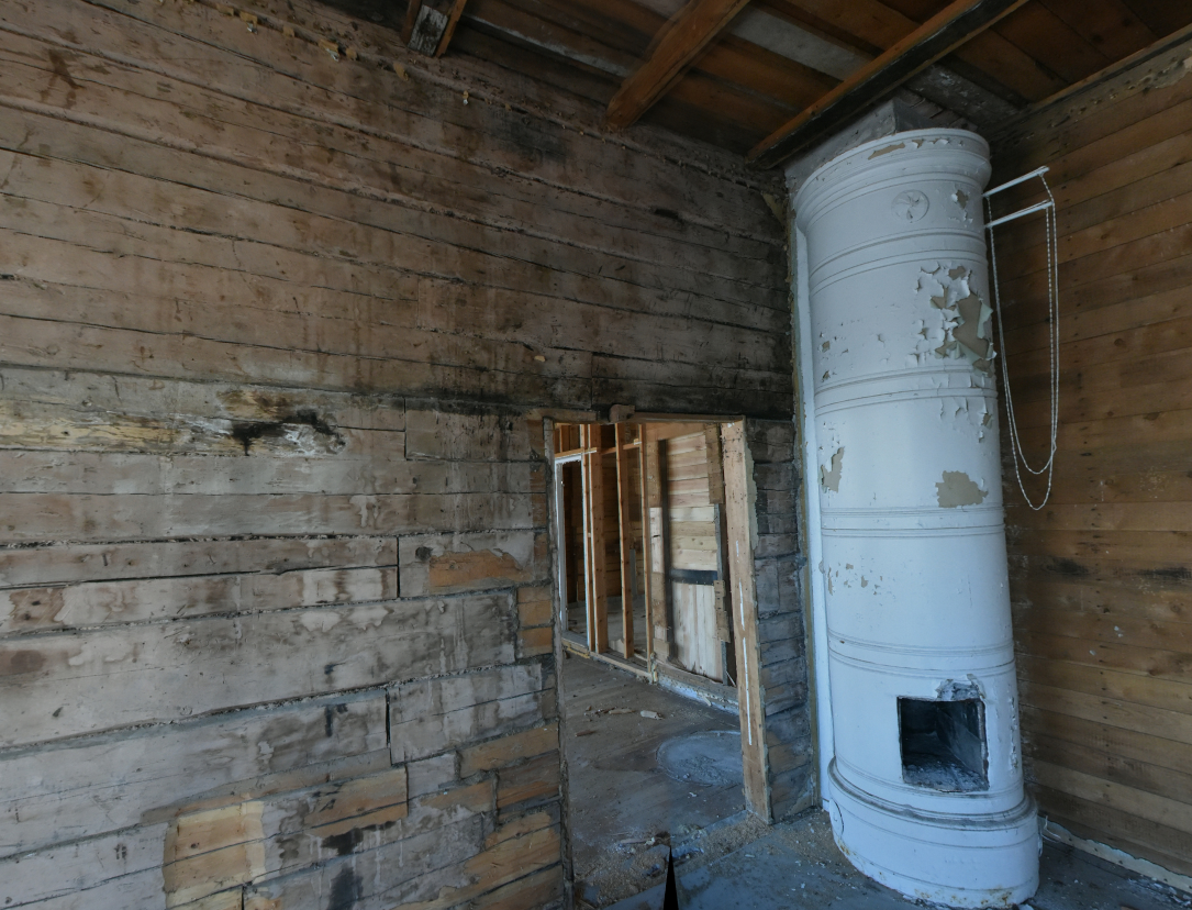
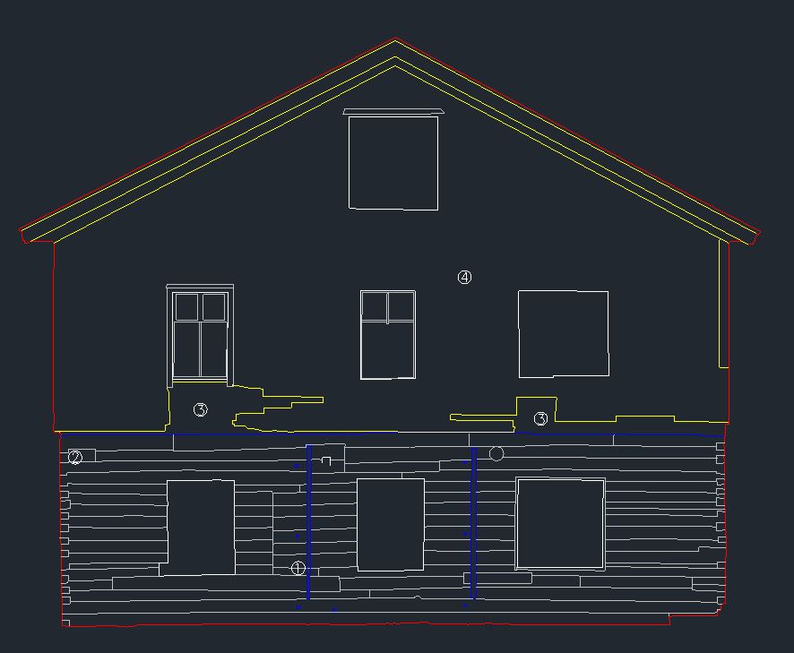
Exposed log walls and the historic tiled stove are almost impossible to measure reliably by hand. For the design process, it was essential to determine the exact width of each log for possible repair or replacement work.
Solution
Atlastica carried out 3D laser scanning at the site, capturing the room, the lines of the logs and the shapes of the historic tiled stove as a complete digital point cloud without damaging the structures.
Benefit
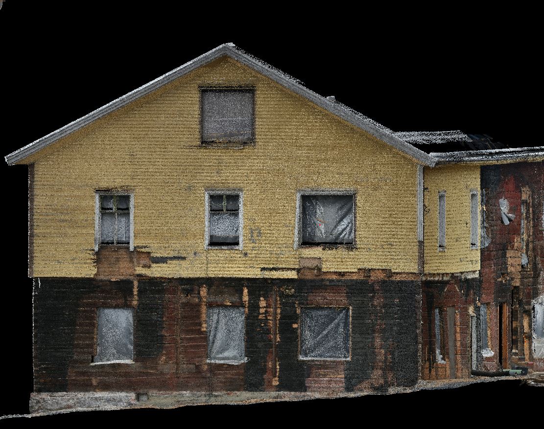
Accurate facade drawings
Drawings were created from the data, showing the widths of the logs individually.
Protection of historic details
Valuable structures and the shapes of the tiled stove were documented without damaging the structures.
Less uncertainty
Millimetre-accurate data ensured successful design work and supported compliance with conservation requirements.
Starting point
On the pedestrian street of Rovaniemi, at Koskikatu 20, the wall of a building was long decorated by the massive bronze relief Aurora Borealis, designed by architect Alvar Aalto and created by sculptor Heikki Häiväoja.
The artwork depicts the northern lights and, in its lower section, a salmon leaping from foaming water.
Challenge
This valuable cultural heritage object had to be removed from the wall in 2010 for safety reasons, as its heavy fixings had loosened and posed a risk of falling. The artwork was absent from the streetscape for as long as 15 years.
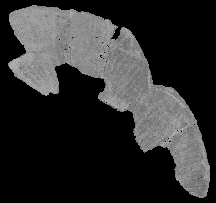
When the return of the artwork, weighing hundreds of kilograms, was being planned, it became clear that the design of robust and hidden rear fixings required flawless, millimetre-level baseline data on the geometry and shapes of the back of the bronze artwork. Designing new and durable fixings was not possible without reliable digital data.
Solution
Atlastica carried out accurate 3D laser scanning of the site. The massive bronze relief, lowered to the ground, was scanned from all sides, and its complex surfaces were captured as a millimetre-level digital point cloud.
Benefit
Dimensionally accurate 3D baseline data
The point cloud provided designers and restorers with a dimensionally accurate digital copy of the artwork's shape and rear-side geometry.
Safe fixing design
New, robust fixing mechanisms could be designed and dimensioned based on the artwork's actual measurements.
Preserving cultural heritage
Thanks to Atlastica's accurate measurement data, the valuable and historic artwork could be returned safely to a public space.