3D laser scanning โ€“ reliable baseline data for planning

Millimetre-accurate 3D documentation for projects of all sizes. We provide reliable baseline data for planning faster and more efficiently โ€“ without costly surprises or delays on site.

Laser scanning to support design and construction

We produce comprehensive and accurate digital data to support the success of your project.

Lifecycle documentation

We accurately document the actual site conditions before earthworks or construction begin, during the work and after the site has been completed.

Easy phase comparison

Data from different work phases can be compared directly. This helps identify potential errors early and reliably verify the siteโ€™s original conditions.

Millimetre-level data

We produce up-to-date and reliable point cloud data and building documentation for construction, industrial and renovation projects.

RiPano โ€“ all your survey data available without licence fees

We upload the laser scanning data directly to our easy-to-use RiPano platform. You receive your own login credentials, allowing you to access the site on a computer or mobile device from anywhere.

๐Ÿ” Inspect the site

Rotate clear 360ยฐ panoramic images and explore the site on any device.

๐Ÿ“ Measure and verify

Measure distances and check elevation data directly in the browser without separate software.

โœ‚๏ธ Create cross sections

Generate accurate cross sections at the correct scale and export them as PDFs.

๐Ÿ“ Plan with confidence

Export data to CAD software and use laser scanning data as a basis for design.

๐Ÿ“„ Use existing drawings

Review and supplement existing building drawings directly through RiPano.

Why RiPano?

  • โœ“ No licence fees
  • โœ“ Works in a standard web browser
  • โœ“ Available on mobile devices
  • โœ“ Reduces the need for site visits
  • โœ“ Speeds up designersโ€™ remote checks and project progress
  • โœ“ The whole team can access the same data

Try it yourself

Explore the RiPano platform with our open demo dataset. The example site is the historic church cottages of Utsjoki, where you can test navigation, measurements and creating cross sections, just as in our real customer projects.

Why choose Atlastica?

๐Ÿค– A complete digital copy of anything that stays still long enough.

At Atlastica, we do not guess โ€” we know. We scan your site with such precision that our laser does not miss a single wrinkle or detail โ€” even the character in the image looks impressed.

Make your project run smoother with data you can trust.

๐Ÿ“ Accurate baseline data

No measurement errors or costly surprises during the planning phase.

๐Ÿ›ก๏ธ Safe surveying

Scanning can be carried out from a distance without interrupting operations.

๐Ÿ“ Planning-ready data

Point clouds, images and RiPano access for the entire planning team.

๐ŸŒ Digital twin

A digital copy of the site that accurately reflects reality.
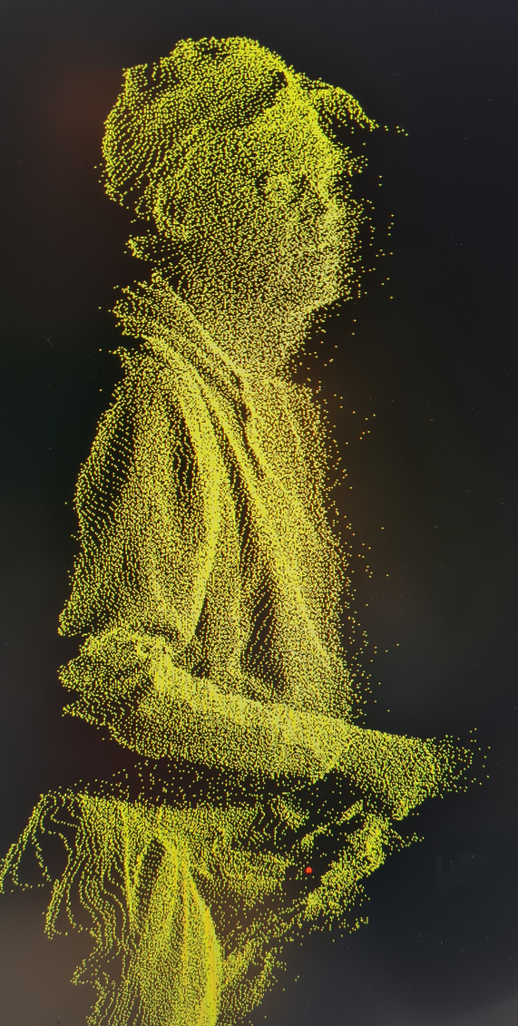
Laser scanning in a point cloud environment

How the project progresses

1

Initial assessment

We review the site requirements and plan the survey according to the project objectives.

2

Scanning

The site is laser scanned quickly and safely without interrupting operations.

3

RiPano

We deliver the data for use in your browser, ready for design and planning.

Explore our work

References โ†’

In cooperation with

We have carried out projects in cooperation with various organisations:

×